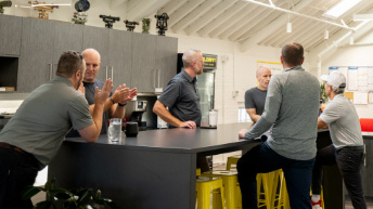
“I feel very good about my communication with my manager and team.”
Build a Career on a Solid Foundation
If you love a challenge, have a talent for practical solutions, embrace new ideas and technologies, and want to be part of a team that strives for success, Feldman Geospatial could be the perfect place for you. Explore our current career opportunities.
A talent for growth
We’re a third-generation family-owned business with a reputation for hiring smart professionals at the top of their game. The skill and commitment of our team have fueled our rapid growth, making Feldman one of the top surveying and geospatial firms in our region.
Refreshing environment
At Feldman, you’ll work in a fast-paced environment that emphasizes teamwork and mutual respect. We recognize and support a healthy balance between life and work. And we promote healthy choices through our on-site workout facility, weekly yoga classes, weekly fruit delivery, healthy fresh vending machine, and ergonomic workstations. You’ll love coming to work.
Elevating careers
We provide a range of career development opportunities for team members across the firm. We nurture future Feldman leaders through our Elevate Leadership Program, providing active mentorship to help them achieve their full potential.
Feldman Geospatial offers highly competitive compensation and a generous package of benefits.
Current Opportunities
Project Surveyor (Maine)
Job Title: Project Surveyor
Location: Portland, ME
Company: Feldman Geospatial
Help us build something new in Maine’s most vibrant city!
Feldman Geospatial, a third-generation, family-owned surveying and geospatial firm, is expanding into Maine with a new office in Portland. We’re combining the excitement and agility of a start-up environment with the resources, reputation, and support of our established Boston headquarters.
As a Project Surveyor, you’ll be a cornerstone of our growing Portland team. You’ll lead field crews, manage survey work from boundary research through final deliverables, and help shape the success of our new Maine operations. This is a unique chance to be part of something new, without starting from scratch.
Responsibilities include:
· Leading fieldwork for boundary, ALTA, topographic, and construction surveys
· Performing office work, including calculations and drafting
· Organizing survey data and preparing deliverables
· Communicating with clients, Project Managers, and team members
· Managing field equipment and ensuring safety practices
We’re looking for:
· 3-5 years of survey experience with a 2-year degree, or 5-7 years of relevant experience
· Strong technical skills in survey principles and software (Carlson, CAD, Microsoft Office)
· Leadership ability and excellent communication skills
· A collaborative spirit excited by building a new office and team
· Valid driver’s license and ability to perform physical fieldwork
Why Feldman?
· Be part of launching our new Portland office
· Enjoy the best of both worlds: start-up energy with established support
· Work on diverse and challenging projects
· Family-oriented, innovative, and supportive culture
· Competitive pay and benefits
Travel: Fieldwork across greater Maine and beyond.
Ready to grow your career and help build Feldman Geospatial’s Maine presence? Apply today!
Equal Opportunity Employer Statement
Feldman Geospatial is an equal opportunity employer. All qualified applicants will receive consideration for employment without regard to race, color, religion, sex, sexual orientation, gender identity, national origin, age, disability status, protected veteran status, or any other characteristic protected by law.
At-Will Employment Disclaimer
Employment with Feldman Geospatial is at-will, meaning either the employee or Feldman may terminate the employment relationship at any time, with or without notice, and for any lawful reason.
Work Authorization
Applicants must be legally authorized to work in the United States without sponsorship.
Project Manager - Subsurface Utility Engineering (SUE)
Job Title: Project Manager – SUE
Location: Boston, MA
Company: Feldman Geospatial
Take your career underground—and beyond!
Feldman Geospatial is a third-generation, family-owned firm known for excellence in land surveying, 3D scanning, and Subsurface Utility Engineering (SUE). We serve diverse clients across Boston and beyond, driven by innovation and a strong team culture.
As a Project Manager in our SUE department, you’ll lead projects from start to finish, balancing client needs, budgets, schedules, and quality. This is a great role for professionals ready to manage diverse, technical projects and mentor others.
Responsibilities include:
· Managing SUE project lifecycles, budgets, and schedules
· Coordinating teams and resources to deliver quality work
· Acting as the main point of contact for clients and stakeholders
· Overseeing data collection, analysis, and QA/QC processes
· Training and mentoring SUE field technicians
We’re looking for:
· 6+ years in SUE or utility mark-out with field and office experience
· Strong knowledge of EMI, GPR, and surveying processes
· Working knowledge of CAD and Microsoft Office
· Excellent communication and problem-solving skills
· Bachelor’s degree in Engineering or Surveying is helpful but not required
· Valid driver’s license and clean driving record
Why Feldman?
· Lead diverse, technical projects
· Be part of a respected, innovative firm
· Collaborative and supportive work environment
· Opportunities for professional growth
· Competitive pay and benefits
Travel: Some travel required to project sites around Boston and surrounding areas.
Apply today and help map what lies beneath Boston’s streets, and build your career above them!
Equal Opportunity Employer Statement
Feldman Geospatial is an equal opportunity employer. All qualified applicants will receive consideration for employment without regard to race, color, religion, sex, sexual orientation, gender identity, national origin, age, disability status, protected veteran status, or any other characteristic protected by law.
At-Will Employment Disclaimer
Employment with Feldman Geospatial is at-will, meaning either the employee or Feldman may terminate the employment relationship at any time, with or without notice, and for any lawful reason.
Work Authorization
Applicants must be legally authorized to work in the United States without sponsorship.
Instrument Operators (Construction and Survey)
Job Title: Instrument Operator
Location: Boston, MA
Company: Feldman Geospatial
Build your career from the ground up!
Feldman Geospatial is a third-generation, family-owned Surveying firm serving diverse clients across Boston and beyond. We’re fun, innovative, and committed to excellence, and we’re growing!
As an Instrument Operator, you’ll work outdoors on exciting projects, operating survey instruments and supporting our field teams. Whether you’re starting out or have experience, we may have a role for you.
Responsibilities include:
· Operating and maintaining surveying equipment
· Performing fieldwork and data collection
· Communicating with the team and reporting challenges
· Following safety protocols
We’re looking for:
· High school diploma (technical training a plus)
· Experience helpful but not required—we train motivated people!
· Good math skills and physical ability for fieldwork
· Desire to learn and grow professionally
· Valid driver’s license and clean driving record
Why Feldman?
· Great projects and diverse clients
· Supportive, family-oriented culture
· Training and growth opportunities
· Competitive pay and benefits
Travel: 100% between job sites in the greater Boston area and beyond.
Apply today and join a team that values Trust, Respect, Accountability, Humility, Health, and Leadership!
Equal Opportunity Employer Statement
Feldman Geospatial is an equal opportunity employer. All qualified applicants will receive consideration for employment without regard to race, color, religion, sex, sexual orientation, gender identity, national origin, age, disability status, protected veteran status, or any other characteristic protected by law.
At-Will Employment Disclaimer
Employment with Feldman Geospatial is at-will, meaning either the employee or Feldman may terminate the employment relationship at any time, with or without notice, and for any lawful reason.
Work Authorization
Applicants must be legally authorized to work in the United States without sponsorship.
Crew Chief (Construction and Survey)
Job Title: Crew Chief (Construction & Survey)
Location: Boston, MA
Company: Feldman Geospatial
Lead the way with Feldman Geospatial!
We’re a respected, third-generation surveying firm delivering cutting-edge services across Boston and beyond. Our team thrives on innovation, collaboration, and a great company culture.
As a Crew Chief, you’ll oversee field crews and manage diverse projects. Whether you’re an experienced leader or ready to step up from an Instrument Operator role, we may have a place for you.
Responsibilities include:
· Leading field operations and supervising crews
· Operating survey equipment and ensuring data quality
· Coordinating with project managers, office staff, and clients
· Upholding safety and training team members
We’re looking for:
· Experience in land surveying or construction
· Strong leadership and communication skills
· Technical skills in survey practices and equipment
· Willingness to grow and develop professionally
· Valid driver’s license and clean driving record
Why Feldman?
· Diverse, exciting projects
· Supportive team and leadership opportunities
· Training and career growth
· Competitive pay and benefits
Travel: 100% between job sites in the greater Boston area and beyond.
Apply today and help shape the future of surveying with Feldman Geospatial!
Equal Opportunity Employer Statement
Feldman Geospatial is an equal opportunity employer. All qualified applicants will receive consideration for employment without regard to race, color, religion, sex, sexual orientation, gender identity, national origin, age, disability status, protected veteran status, or any other characteristic protected by law.
At-Will Employment Disclaimer
Employment with Feldman Geospatial is at-will, meaning either the employee or Feldman may terminate the employment relationship at any time, with or without notice, and for any lawful reason.
Work Authorization
Applicants must be legally authorized to work in the United States without sponsorship.
Project Manager (Survey)
Job Title: Project Manager – Survey
Location: Boston, MA
Company: Feldman Geospatial
Lead projects from the ground up!
Feldman Geospatial is a third-generation, family-owned firm known for excellence in land surveying, 3D scanning, and geospatial services. Serving diverse clients across Boston and beyond, we thrive on innovation, precision, and a strong team culture.
As a Project Manager in our Survey department, you’ll oversee a variety of surveying projects from proposal to completion. You’ll work closely with clients, field crews, and office staff to deliver high-quality work on schedule and within budget. This role is perfect for professionals who love both technical detail and team leadership.
Responsibilities include:
· Managing surveying projects, schedules, and budgets
· Serving as the main point of contact for clients and stakeholders
· Overseeing field crews and ensuring quality data collection
· Coordinating CAD and data processing workflows
· Performing QA/QC reviews of survey deliverables
· Mentoring and training team members
We’re looking for:
· 6+ years of land surveying experience, including project management
· Strong knowledge of surveying practices, field methods, and instruments
· Working knowledge of CAD software (e.g., Civil 3D, Carlson)
· Excellent communication and problem-solving skills
· Ability to lead and motivate teams
· Valid driver’s license and clean driving record
Why Feldman?
· Diverse, high-profile projects
· Supportive, family-oriented work environment
· Opportunities for professional development and growth
· Competitive pay and benefits
Travel: Some travel required to project sites across the Boston area.
Apply today and help shape the landscape—literally and professionally—with Feldman Geospatial!
Equal Opportunity Employer Statement
Feldman Geospatial is an equal opportunity employer. All qualified applicants will receive consideration for employment without regard to race, color, religion, sex, sexual orientation, gender identity, national origin, age, disability status, protected veteran status, or any other characteristic protected by law.
At-Will Employment Disclaimer
Employment with Feldman Geospatial is at-will, meaning either the employee or Feldman may terminate the employment relationship at any time, with or without notice, and for any lawful reason.
Work Authorization
Applicants must be legally authorized to work in the United States without sponsorship.
Feldman Geospatial is an Equal Opportunity Employer. We prohibit discrimination based on race, color, religion, age, sex, national origin, disability status, protected veteran status, sexual orientation, gender identity or expression, or any other characteristic protected by federal, state or local laws.
Tell us what’s next. We’ll help you see it.
Every Feldman project starts with a consultation. Tell us what you’re working on—we’ll tell you how we can help make it great.


